Ancient Volcanic Eruption Caused Collapse of Egyptian Dynasty

erupting.jpg

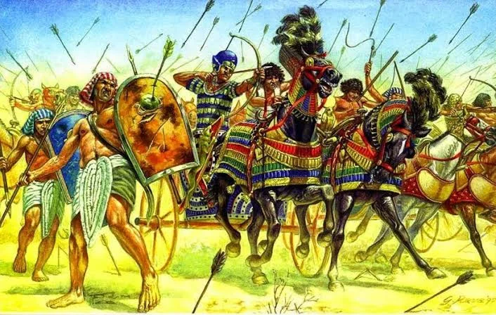
2,000 years ago Egypt's last dynasty collapsed after volcanic eruptions prevented monsoon rains from swelling the Nile, thus causing economic pressures and revolt.

Wow, what an example of the "butterfly effect!" This is a lesson to all of us of our interconnection to natural events and their consequences in our seemingly independent lives.


The ancients believed in following the course of nature and maintaining harmony with nature.

unnamed-43.jpg

As you will see, they had very good reason to. Nowadays, the average person living in the developed world may only consider nature when checking the weather to pick what clothes to wear, but in traditional culture, people deviating from the natural seasonal cycles could mean starvation for an entire nation! Large natural disasters were viewed as the responsibility of the ruling monarchy who would even make a public apology to the people and make changes to fulfill his duty to his people's well being. 

Yale University historian Joseph Manning and his colleagues compared records of Nile River heights dating back to A.D. 622 with 2,500 year-old ice cores from Greenland and Antarctica with layers of volcanic ash matching the years the Nile's waters did not rise high enough.


Less flooding meant less food, which meant poverty, revolt, and the eventual end of Egypt’s Ptolemaic Kingdom.

102500-004-FD431E88.jpg

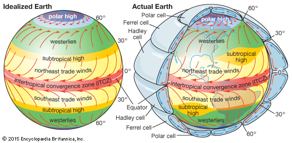
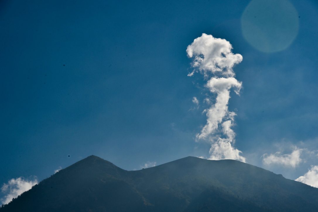
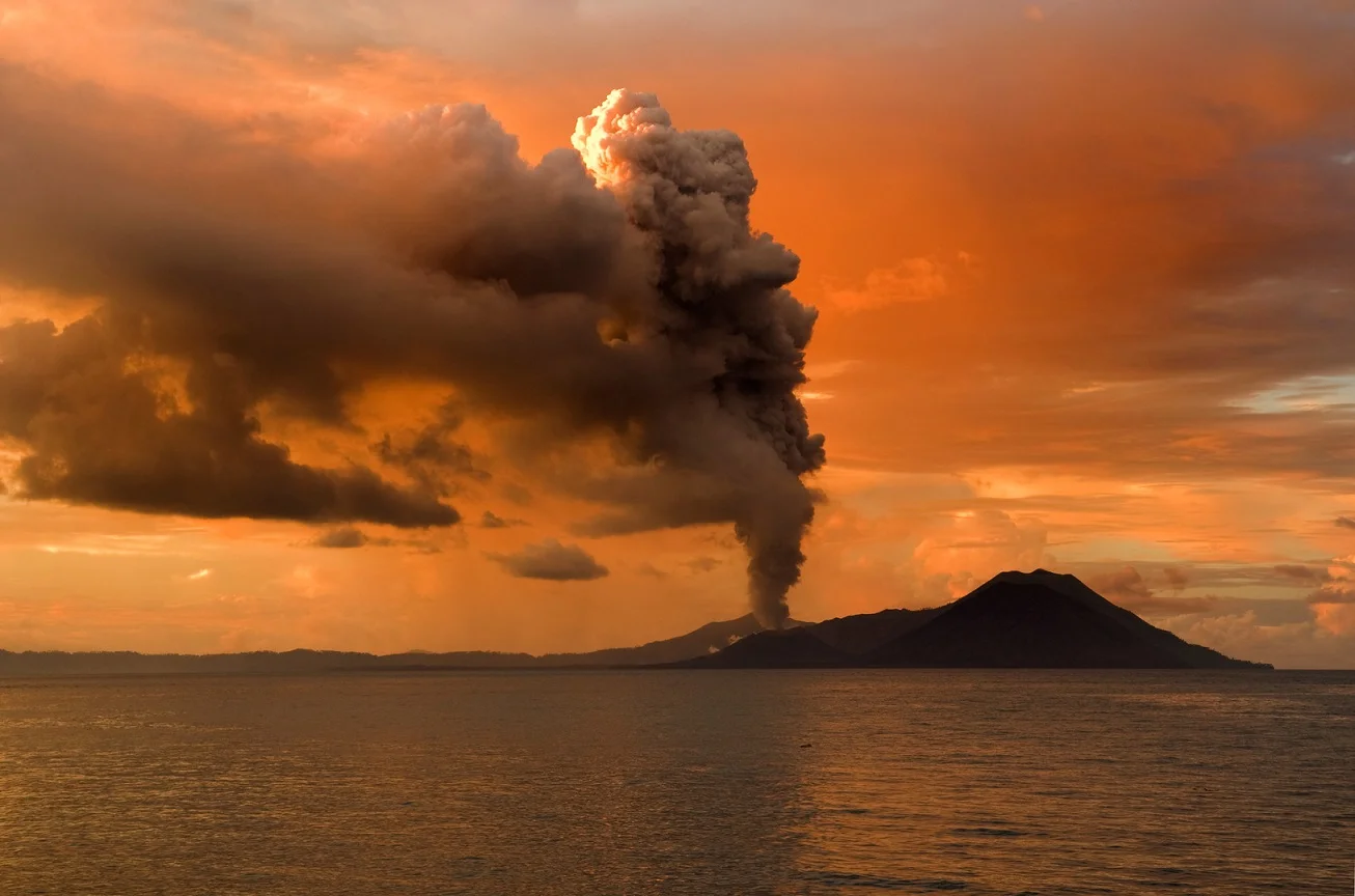
Each volcanic eruption limited rainfall across Africa where the Nile receives water from. Such eruptions impact monsoons via a low-pressure belt near the earth's equator called the Intertropical Convergence Zone that governs rain cycles. Basically, the volcanic ash blocked monsoon weather from watering the Nile and caused turmoil in human society. 

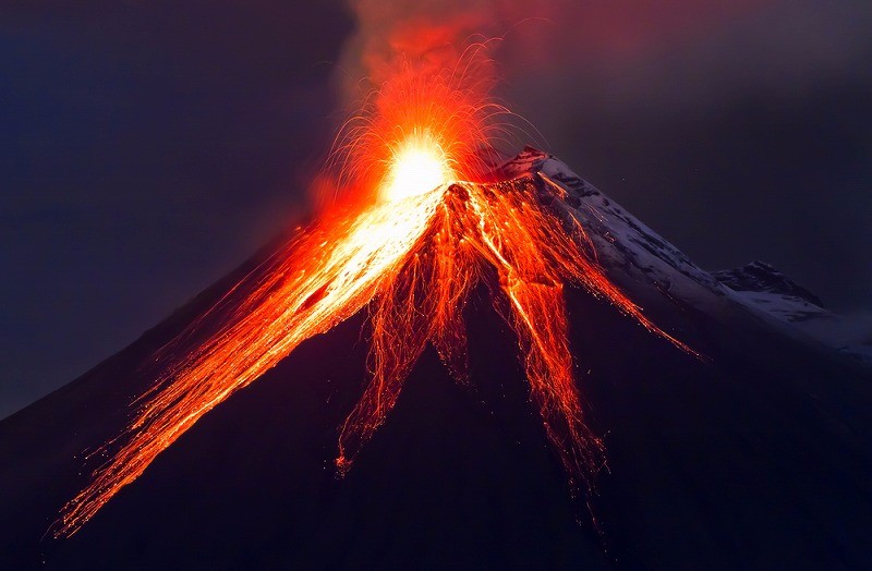
Manning and researchers found recorded revolts matched the dates of volcanic eruptions. During Italy's Mount Etna's massive explosion in 44 BC, there were political earthquakes, starvation, and drought. Coincidence? I think not. 

This research is astonishing and points to the affects of other natural disasters to our civilization and social behaviors. With all of today's hurricanes, wildfires, earthquakes, and political tension, let us remind each other to re-align to the natural way because our actions also influence the greater world around us that we all live on. 


Sources:

https://www.sciencenews.org/article/how-volcanoes-may-have-ended-dynasty-ptolemy-and-cleopatra?mode=topic&context=60

https://www.nature.com/articles/s41467-017-00957-y

Italy's Supervolcano Is More Deadly Than We Thought

GETTY IMAGES

GETTY IMAGES

Hephaestus, also known as Vulcan, is an ancient Roman God.

In Latin, Vulcanus is the god of fire, which includes fire from volcanoes. The word “volcano” is thought to come from the island of Vulcano, located in the Mediterranean Sea off the coast of Sicily. The Romans believed that the volcano was the chimney of Vulcan’s workshop. The island itself was thought to come from the debris that came out of the furnace of the god. The Romans also believed that earthquakes occurred when Vulcan was working in his shop; creating godly weapons for the other deities. Well, Italy’s Supervolcano is also linked to ancient legends. People in Italy have said that since antiquity, the Italian supervolcano, known as the Campi Flegrei, has been associated with Hell and Underworld.

This smoking sulfurous landscape is one of the most dangerous volcanos in the world. One of the reasons is that at least 1 million people are living around it. Up until now, it has not been the topic of much worry. However, a new study in the journal Scientific Reports may have identified the source of the magma that is fueling the volcano. Worryingly, it shows that this volcano is much more dangerous than anyone truly anticipated.

Pisciarelli fumaroles and mud pools from the Campi Flegrei caldera, near Naples/GETTY IMAGES

Pisciarelli fumaroles and mud pools from the Campi Flegrei caldera, near Naples/GETTY IMAGES

Under normal circumstances, experts and scientists can use seismic waves to identify and locate where the magma is with significant accuracy. Campi Flegrei has been asleep and quiet since the mid-1980’s, which means that it is more difficult to locate its origin and the molten horrors beneath.

An international team led by Dr. Luca De Siena at Aberdeen University decided to try and solve this puzzling mystery. The team used a specialized type of mathematical analysis and seismic data collected from the time it was last active: the mid-1980’s, and using these, they located a hot zone, just around 4 kilometers (2.5 miles) beneath a town near Naples, known as Pozzuli.

According to the team’s scientific reports, what they found is either a small batch of magma or worse, the molten top of a massive magma chamber that has spread its liquid fire deep beneath the surface. Either way, it is strong evidence that an active heat source exists and is contributing to the magma supply of one of the world’s most dangerous volcanos. But know that the story does not end there. Another mystery is the Campi Flegrei’s periodic and frightening inflation. In the period between 1982 and 1984, the ground within the crate expanded by 1.8 meters. A new study offers up an explanation as to why this inflation did not result in a volcanic eruption. One theory is based on the rock formation above the magma, which would have prevented it from breaching the surface. The magma would have been forced to spread out laterally and therefore, failed to erupt.

The area surrounding Campi Flegrei/WIKIMEDIA

The area surrounding Campi Flegrei/WIKIMEDIA

Campi Flegrei remains an enigma. Since the formation of Campi Flegrei 40,000 years ago, it has had only a few violent eruptions.

One of the current concerns that researchers have is that Campi Flegrei is again, inflating. However, this time it is 24 times smaller than the 1980s inflation. As for now, volcanologists are not sure of what is happening, but a consensus can be made that this volcano has been bubbling towards a critical point since 2005. There is no doubt that the volcano will keep rising to become more and more dangerous. Dr. De Siena warns, “In case of a big one, it could affect our chances to live in Europe, immediately killing hundreds of thousands if not millions.”

“Ashes would cover the sun, possibly for days/months/years, affecting humanity, fauna, and flora in other continents.”
SOURCE: 3BMETEO

SOURCE: 3BMETEO

The most worrying aspect of this volcano is that an eruption is almost impossible to predict and certainly impossible to prevent with our current technology. What we can do is prepare. Dr. De Luca says, 

“We must become conscious that a volcano eruption of this kind may completely change our way of living - and in the future will surely do."
“To mitigate this means to invest in technologies that allow humanity to survive and prosper even after.”

This sleeping giant, known to be the "big daddy" to Vesuvius (the volcano that wiped out Pompeii) is awakening, and it is definitely something that we need to keep an eye on. 

MOUNT AGUNG: Threat of Volcanic Eruption Reaches HIGHEST Alert Level in Indonesia

CREDIT: BAY ISMOYO/AFP/GETTY IMAGES

CREDIT: BAY ISMOYO/AFP/GETTY IMAGES

Mount Agung, also known as Gunung Agung, is a volcano located in Bali, Indonesia. It can be seen to the south-east of the Mount Batur volcano. Gunung Agung is a stratovolcano, which means that it is a conical volcano made up of many layers of hardened lava, tephra, pumice and volcanic ash. Stratovolcanoes are characterized by a steep profile and periodic explosive eruptions as well as effusive eruptions (a type of eruption where lava continuously flows down onto the ground). An ethnic group called the Balinese believe that Agung started as a fragment of Meru (a sacred cosmological mountain with five peaks in Hindu, also considered to be the center of all the physical, metaphysical and spiritual universes) brought to Bali by the first Hindus.  

COLLECTIE_TROPENMUSEUM_Meru_op_het_tempelcomplex_bij_Besakih_met_de_gunung_Agung_op_de_achtergrond_TMnr_60030939.jpg

Mount Agung was last known to erupt in 1963, when lava travelled 7km over a period of 20 days and killed almost 1,500 people. The eruption was preceded by an increased frequency in earthquakes. Since the eruption, Mount Agung has remained quiet. Mount Agung has not erupted for more than half a century which leads experts to believe Mount Agung is due for an eruption very soon.

21688344_1586022304793632_9073292952356709628_o.jpg

But the problem is - they don’t know when. Recently, Indonesian authorities have announced the highest possible alert warning. Over 100,000 people were evacuated last week after Agung experienced a series of almost 1200 volcanic earthquakes over two days.  Scott Bryan, an associate professor at the Queensland University of Technology, also states that there are have been numerous signs that an eruption will occur soon. He said that the fact that the seismic tremors located beneath the volcano are increasing in number, intensity, and also the reduction in their depth, is one of the main hints that magma is moving up to the high ground. Besides having seismic activities, there are other two signs that a volcanic eruption is coming: gas Emissions on the summit and bulging on the volcano’s surface.

When volcanoes erupt, the earth becomes cooler. A lecturer in volcanology from the University of Queensland, Teresa Ubide, explained that the cooling effect after an eruption is caused by sulfur emissions from the volcano. Basically, when a volcano that generates sulfur-based aerosols erupts, the sulfur emissions block the radiation of the sun, and we will experience a decrease in global temperature. Similar to what happened in 1963 when Mount Agung erupted, the global temperature dropped by 0.1°C and 0.4°C. When Mount Pinatubo in the Philippines erupted in 1991, global temperatures decreased by 0.5°C.

627055-volcano.jpg
500px-Arenal_at_night.jpg

Although it does not sound like a huge difference, we have to remember that the earth is very sensitive and even the smallest changes will impact global climate systems in drastic large ways. You may think that this may help to reverse some of the effects of global warming, but ironically, it actually makes it worse. How? Volcanoes excrete carbon dioxide. On average, land-based and water-based volcanoes release between 100m – 300m carbon dioxide each year.

So what will happen if Mount Agung does erupt? In terms of safety, the Indonesian officials are much more prepared for an eruption to occur this year, taking many precautions to keep people safe and are monitoring the situation very closely. Professor Mike Burton, the chairman of volcanology at Manchester University, believes that monitoring and consistent communication using modern technologies will allow many more locals to get out of danger in time.

No one can predict the future, but everyone can prepare for what will come next.


5 Mega Disasters that Can Happen Tomorrow

Every morning we wake up brings us closer and closer to a catastrophic disaster that could spell doomsday for the entire human race. In the morning while we enjoy our cup of coffee, a mega earthquake is ready to shake things up under our feet. While we mix milk with our favorite cereal in our favorite bowl, a super volcano is slowly waking up to spread Armageddon the moment we clock into the office. On our daily drive, facing rush hour traffic, the ground may open up without warning, swallowing every car, pedestrian, and building in its wake.

There are so many nightmare scenarios that have a high possibility of happening within the next three or five decades, and there is nothing that we can do to prevent it because nature runs on its own schedule. All that we can do when it happens — or before it happens — is to stay prepared for the worst. 

From super volcanic eruptions to a super tsunami that can wipe out an entire chain of island from the earth, natural disasters are always lurking at every corner.


#5 — West Coast Wildfires

The State of California is no stranger to wildfires. Every year, hundreds upon hundreds of acres are burned down by forest fires that seem to be getting worse over time.
In fact, in a study made by the US Geological Survey and Forest Service, they reported that the acreage burned by wildfires has skyrocketed to 6.4 million since 1999, drastically tripling from an annual 2.2 acres. If this number keeps on going up, experts predict that a large portion of the country will be up in flames in the very near future. Also, according to the Harvard School of Engineering and Applied Sciences or SEAS, wildfire seasons in the United States will be twice as smoky and will last longer by three weeks, unforgivably burning and scorching massive portions of the West each year.

Additionally, SEAS points out that the increase in the Earth’s temperature due to climate change has greatly contributed to the worsening situation of annual wildfires. Dr. Loretta J Mickley, a SEAS Senior Research Fellow in Atmospheric Chemistry shares that climate temperature is indeed the biggest factor in determining future wildfires. It is more likely that the fires will get fiercer as climate temperatures continue to rise, she adds.

To add more salt to the wound campaigns to stop forest fires like “Smokey the Bear” has only exacerbated the problem because it prevents the natural cycle of brush fires that clear out the forest underbrush. The irony, unfortunately, is not lost here.

Today, with predictions of 30,000 to 50,000 annual wildfires, the US might eventually end up experiencing its literal version of Hell on Earth.


#4 — The East Coast Submerged

sea-level.jpg

In 2012, Hurricane Sandy submerged a lot of major US cities underwater, and it was considered by many experts as one of the most devastating freak storms to ever hit the country in 700 years; but with the rising sea levels along the East Coast of the US, we may not even need a storm like Sandy or Katrina to see major cities get swallowed up by water.

John Boon, Professor Emeritus of the Virginia Institute of Marine Science outlined a study and claimed that a significant change in sea level has been occurring since 1987 spanning the coastlines of Key West, Florida to Newfoundland, Canada. What is concerning about the study is that shows that sea levels are increasing at 0.3 millimeters annually. Even more troubling is a study by the US Geological Survey claims that water levels in the East Coast of the country are rising three to four times faster than anywhere else in the globe, making plenty of the coastal areas in the northeast at high risk because of property values.

The sea levels in New York city alone is expected to rise by 31 inches in 2050, submerging 25 percent of the city as well as rendering 97 percent of its power plants utterly useless.

With about 800,000 people living in high-risk flood zones, former New York Mayor Michael Bloomberg proposed to create a flood system in 2013 worth $20 billion to save the sinking city. Unfortunately, the project was never put into action and is now collecting dust in a dark corner somewhere.


#3 — The Eruption of Mt Fuji

fujisanssa2.jpg

When Japan’s entire landmass shifted during the Tohoku earthquake, it also stirred 20 of the country’s 110 volcanoes awake after increased seismic activities in their areas were recorded. Even more unnerving is the fact that any one of these volcanoes may erupt any day according to the Japan Meteorological Agency.

No stranger to tremors, Japan has suffered a sufficient amount of damage from earthquakes over a thousand years. However, when we are talking about dormant volcanoes waking up, the whole scenario has added much more fear into the mix.

In recent studies, calculations show that Japan is always due for a major volcanic eruption every 38 years and it seems that the country is overdue for one. Out of the 110 volcanoes dotting the island country, 47 are recorded as active.

Among the 47 active volcanoes is the famed Mt Fuji. Standing at a magnificent height of over 12,000 feet, it is one of the volcanoes that are most likely to erupt any time after a report was published by a scientific team from France and Japan.

The news caused great concern to Japanese citizens as Mt Fuji is located 62 miles from Tokyo. Should the volcano decide to erupt tomorrow it would mean that about 750,000 people will be evacuated from the city as it will most likely be covered in ash and volcanic material; practically decimating the country’s capital and nearby areas.


#2 — The Big One Shaking California

san-andreas-original-motion-picture-soundtrack.jpg

The likelihood of at least a magnitude 8.0 earthquake hitting California in the next few decades was increased by the US Geological Survey. Called as “The Big One” by many Californians, it is the one earthquake that they say will reduce the entire state into rubble and the one that everyone in the entire country has been nervously waiting for.

The US Geological Survey goes even further in their findings saying that a magnitude 8.0 quake or larger has a 7 percent chance of hitting California in the next 30 years. However, from their recent findings, the odds of a 6.5 – 7.0 magnitude quake ripping through the West Coast state has gone up to 30 percent. 

Most likely, the cause of The Big One will most likely originate from the breaking of the San Andreas Fault. However, other theories suggest that the mega quake will be triggered by the lesser known Hayward Fault that sits in proximity to San Francisco.

Regardless of the origin, experts all agree on one thing: the earthquake will definitely devastate the entire state of California and neighboring areas on the West Coast. Basing their claims through historical-data based projections, the earthquake will be predicted to cause severe damage to major infrastructure and start full-scale wildfires due to the amount of dry brush that is common in the state.

It is essentially a race against time as the White House has recently granted $5 million to a team of experts coming from UC Berkley, Caltech, and the University of Washington to develop an Earthquake Early Warning System that, hopefully, will alert people a full minute before a tremor hits. Unfortunately, the current system that has been developed is only able to predict a quake 10 seconds before it hits.


#1 — The Caribbean Tsunami

tsunami-1.jpg

In 2001, two researchers from the University College of London and the University of California Santa Cruz hypothesized that the imminent eruption of the Cumbre Vieja volcano in the Canary Islands would create the largest and most destructive tsunami in recorded history.

Published in a co-authored study, Dr. Simon Day from the University College of London, and Dr. Steven Ward from UC Santa Cruz claimed that during the volcano’s last eruption, a large rupture appeared on its left side which has made the geological structure quite unstable.

If Cumbre Vieja erupts, the rupture to its side will result in a catastrophic landslide that will create the tsunami that will basically wipe out all the islands in the Caribbean on a scale that can only be compared to the mythical Atlantis.

With gigantic waves that are predicted to travel at 800 miles per hour and grow to at least 330 feet tall upon the first impact with land, the tsunami is believed to hit as far as Florida within nine hours of its creation. As the rippling continues to build waves, the monster tsunami is also projected to hit as far as England.

Dr. Day and Dr. Ward paint everything as a worst-case scenario, since it is impossible for an entire landmass to fall into the water in one event. More likely, parcels of land and rock from the volcano will tumble into its nearby waters gradually, creating destructive waves if not a tsunami itself.


Sources:
http://listverse.com/2015/05/25/10-major-natural-disasters-predicted-in-the-near-future/
http://theconversation.com/five-global-catastrophes-that-could-happen-tomorrow-48420
http://101waystosurvive.com/emergency_prep/10-major-natural-disasters-predicted-soon/